
Riyadh East
Middle East & Africa
View Project

A Free Trade Zone masterplan for Nigeria’s capital
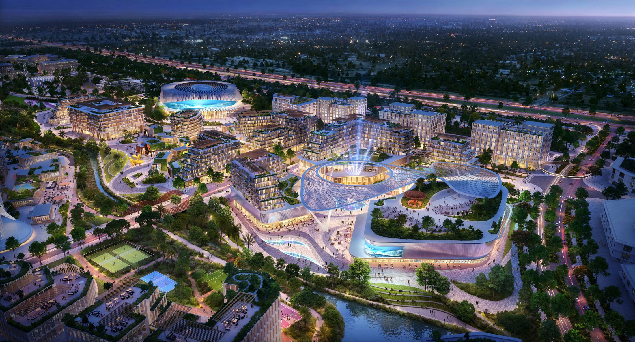
City Walk is a 250-hectare mixed-use masterplan on Airport Road, Abuja – Benoy’s first project in Nigeria and a development of continental significance. The masterplan establishes a new Free Trade Zone at the point where the capital first presents itself to international visitors, investors and businesses, integrating trade, civic, cultural and residential life within a single urban framework. Two continental records define its identity: Africa’s tallest tower, at 450 metres, and Nigeria’s largest indoor arena, with a 13,000-seat capacity.

250 hectares
A north–south city
Benoy’s Commercial Strategy team opened the work with Highest and Best Use studies, defining the programme mix and density across the site. The masterplan is organised around a strong north–south connector, from the active northern gateway on Airport Road, home to the arena, tower, and a hub for food, art and nightlife, to the quieter southern edge, where the city transitions gradually into intimate residential compounds and landscaped gardens. The Ravine forms the green spine of the scheme, structuring landscape, ecology, stormwater management and wellbeing throughout. A light mobility network of low-carbon shuttles, bikes and micromobility systems connects the residential, cultural and commercial districts, reducing car dependency across the site.

At the heart of Phase One, which will deliver 245,000m² of built space, is the Art District, 12,000 square metres of cultural space within a mixed-use block of residences, retail and public realm, connected via a gateway boulevard to an event piazza and retail and leisure plaza. Phase One also encompasses urban apartments, townhouses and garden apartments alongside the arena, hotel, offices, retail, a school, university campus and hospital, serving residents across every stage of life.
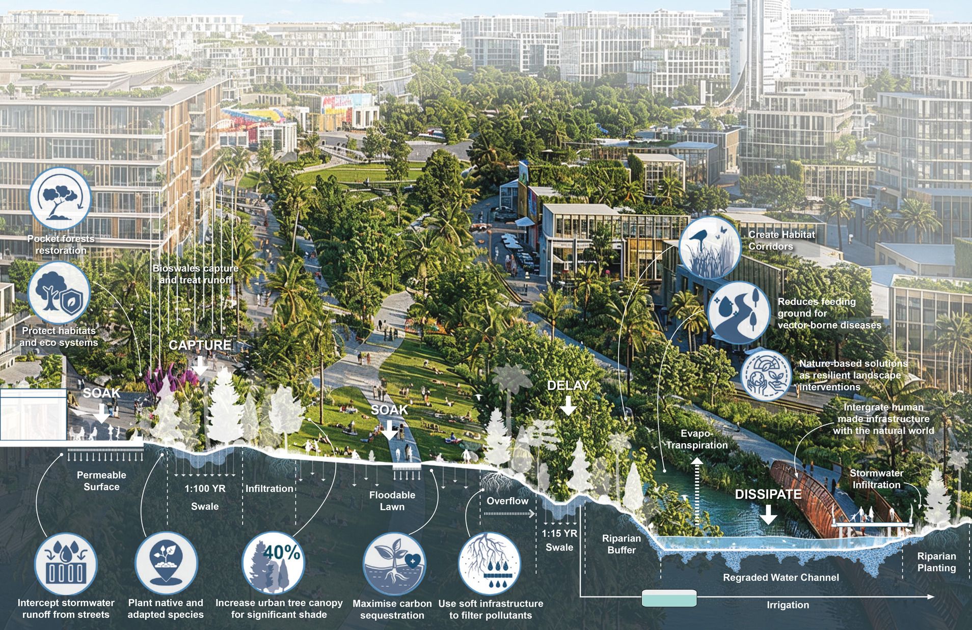
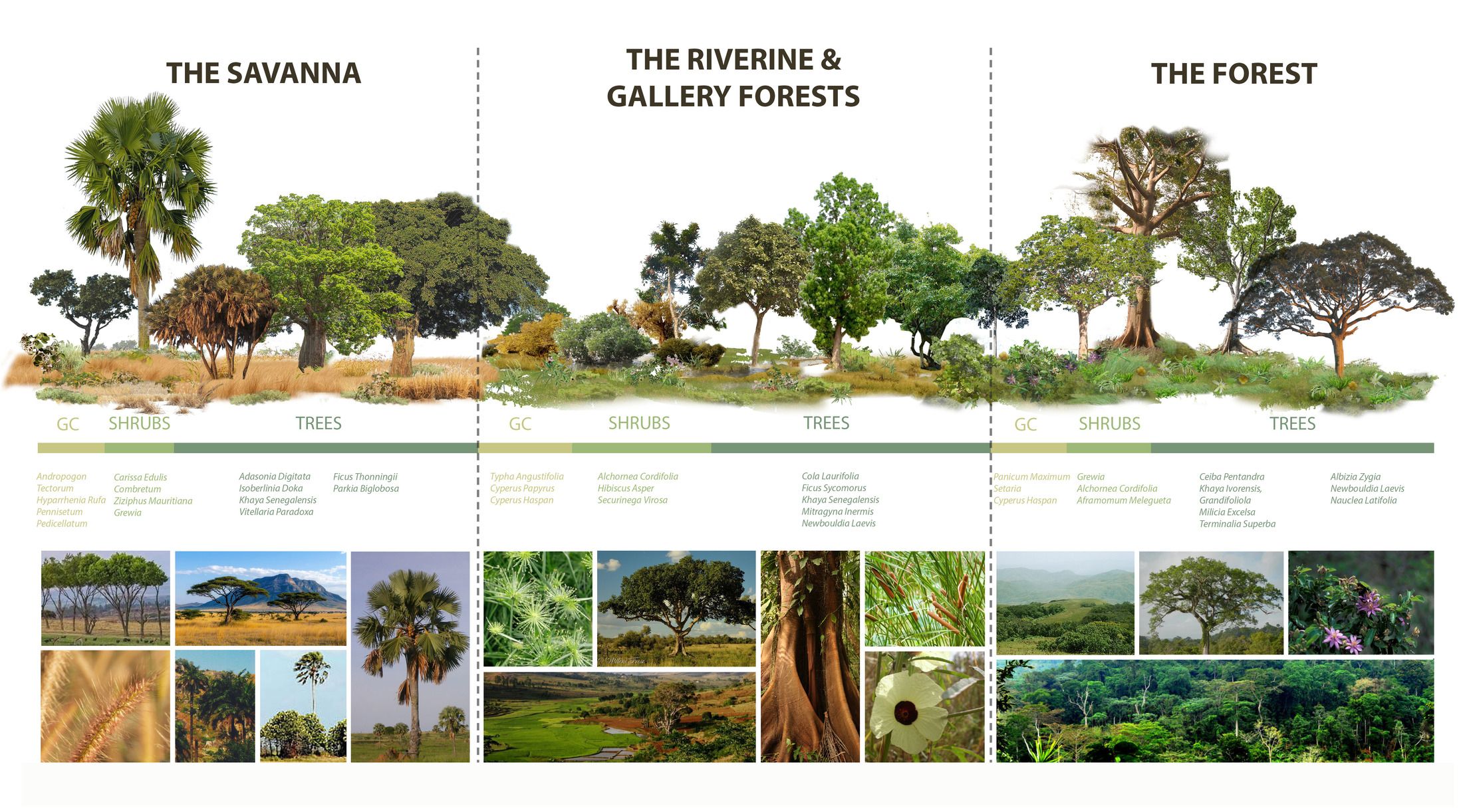
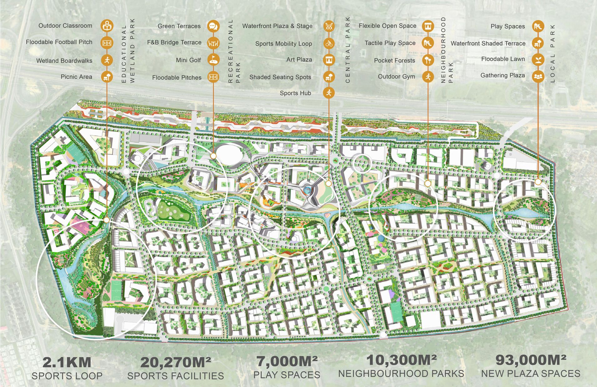
The masterplan explores how landscape can operate as a localised layer of infrastructure, working alongside engineered systems to deliver on-site water management, ecological rehabilitation, and accessible public space. The landscape design provides a 40% urban canopy cover, creating shade while mitigating the heat island effect. Beyond the benefit to people, the tree cover also provides corridors for birdlife, and pocket forests help restore ecosystems and protect habitats.
Flood-resilience was key to the landscape approach. A network of swales, wetlands and permeable surfaces that slow, store, filter and dissipate stormwater, including for 1-in-100-year events, create a ‘sponge city’ effect. These systems manage water directly on-site, improving water quality while reducing reliance on surrounding, often incomplete, drainage infrastructure.

